
A new way to automatically build road maps from aerial images
Table of Contents
“RoadTracer” system from MIT’s Computer Science and Artificial Intelligence Laboratory could reduce workload for developers of apps like Google Maps.
Source: mit.edu
“RoadTracer” system from MIT’s Computer Science and Artificial Intelligence Laboratory could reduce workload for developers of apps like Google Maps.
Source: mit.edu
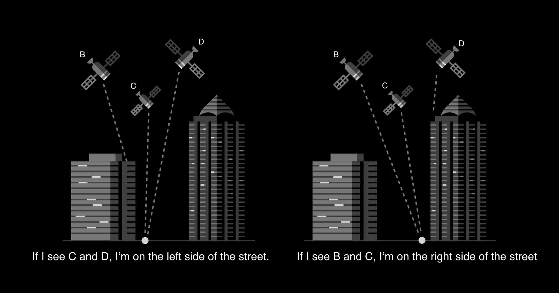
Location and navigation using global positioning systems (GPS) is deeply embedded in our daily lives, and is particularly crucial to Uber’s services. To orchestrate quick, efficient pickups, our GPS technologies need to know the locations of matched riders and drivers, as well as provide navigation guidance from a driver’s current location to where the rider needs to be picked up, and then, to the rider’s chosen destination. For this process to work seamlessly, the location estimates for riders and drivers need to be as precise as possible.
Read More
If there’s one thing China’s tech giants are known for, it’s their ability to venture into everything from social media, to online payments, to delivery services. The latest thing they’re all speeding towards? Autonomous driving.
Read More
Teaching a machine to master car racing and fireball avoidance through “World Models”.
Read More